
 Česky
Česky Deutsch


Alps 4000
Best ski tours
-

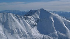
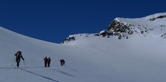
Fenetre Ferret - H.R. Grande Lui, Day 3 2698 m
La Fouly Walliser Alpen / Alpes valaisannes Switzerland
- Length of ascent11 km
- ascent1330 m
- duration5-7 h
- Fitness difficulty ♦♦♦◊
- Technical difficulty ♦♦◊◊
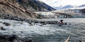
The Haute Route Grande Lui variant from Chamonix to Zermatt, also known as the "Haute Route Pure", leads from La Fouly to the Grand Saint Bernard Pass. Overnight accommodation is provided in the hospice of the same name, under conditions similar to those in a mountain hut. The traverse of the slope below the Ferret lakes is particularly prone to avalanches.

-
Baranec 2184 m
Žiarska chata Západné Tatry Slovakia
- Length of ascent2,7 km
- ascent900 m
- duration4-5,5 h
- Fitness difficulty ♦♦♦◊
- Technical difficulty ♦♦♦♦
Baranec is the highest ski tour above the mountain hut Žiarska chata. The most popular variant is Jarný žlab. First, near the hut overcomes the creek. Then follow the ascent through the Jarný žlab, on the steep slope to the ridge. It goes up easier. It is recommended descent trough the Jarny žlab or the neighboring Maďarský žlab. The descent through the Baranecký kotol is very difficult and dangerous.
-
Schalfkogel E (Langtalereck H.) 3537 m
Langtalereckhütte Ötztal Alps / Alpi Venoste Austria
- Length of ascent7 km
- ascent1500 m
- duration5,5-7 h
- Fitness difficulty ♦♦♦◊
- Technical difficulty ♦♦♦◊
Schalfkogel (Langtalereck Hütte, Ötztaler Alpen) is a relatively demanding tour. After climbing the glacier Gurgler Ferner is a challenging steep steep part of the glacier Kleinleiten Ferner. From the saddle Schalfkogeljoch longer and harder ascent without skis. The mountain is also accessible from Martin Busch Hütte.
Information about Skitours and Mountain huts
-
 skitours and mountain huts

5 Skitouren in Kärntens Bergen
Bergwelten.com bergwelten.com 12. 01. 2019 German
n den Nordalpen bleibt die Lawinensituation weiterhin angespannt (Lawinenwarnstufe 4 bis 5). Doch südlich des Alpenhhautpkamms, in den Gailtaler-, Lavanttaler und Karnischen Alpen sowie den Karawanken, herrschen momentan gute Tourenbedingungen. Wir stellen euch 5 Skitouren in Kärnten vor.
tags: Kärnten
-
 skitours and mountain huts

New Zealand Ski Touring Experience 2018
wildsnow.com Julia Dubinina 5. 11. 2018 English
Our NZ adventure began with 20+ hours of travel, learning to drive on the wrong side of the road in a giant camper van, consuming delicious meat pies, visiting friends, a bit of sleep, and lots of sheep...
tags: New Zealand
-
 skitours and mountain huts

Coast Mountain Traverse Complete!
backcountryskiingcanada.com Backcountryskiingcanada.com 19. 01. 2018 English
I understand that's it's officially summer today and skiing might be in the summer storage bin on the back burner of your mind but the Coast mountain epic has finally been completed. If you haven't been following this epic saga here's the nitty gritty of what you need to know.
-
 skitours and mountain huts
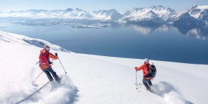
Vom Gipfel bis zum Fjord: Skitouren in Nordnorwegen
Bergwelten.com Bergwelten.com 1. 12. 2017 German
Unverspurte Pulverschneehänge, Abfahrten vom Gipfel bis zum Fjord und dann mit dem Boot zurück zur Lodge wo der Whirlpool...
tags: skitouring
-
 skitours and mountain huts
Ski Norway
tetongravity.com Robert Pursell 20. 11. 2017 English
The Way It Was Always Meant To Be Skied: By Train