
 Česky
Česky Deutsch


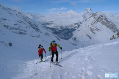
Rifugio Torino is a well-known high mountain hut located above Courmayeur in Italy, directly below Pointe Helbronner (3462 m) in the Mont Blanc massif. In winter, a winter room is open, providing access to glacier ski mountaineering tours in the Mont Blanc area. In summer, the hut is most easily reached from Courmayeur by the Skyway Monte Bianco cable car. It serves as a starting point for ski mountaineering tours to peaks such as Tour Ronde, Mont Blanc du Tacul, the Col du Tacul pass, or for the famous Vallée Blanche descent to the Mer de Glace and the train at Montenvers.
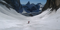
Tours starting from hut
Ski tours around Hut Rifugio Torino

- Country
- Italy
- Montains
- Monte Bianco
- Open (winter)
- no
- Beds
- 160
- Winterraum
- yes, 12 beds
- Shortening of access (cableway, lift, taxi, snowcat...)
- yes, from Aiguille du Midi and Punta Heilbronner
- Luggage transport
- no
- UTM / CH1903 x ("longitude" E/W)
- 32T 339567
- UTM / CH1903 y ("latitude" N/S)
- 5078853
- GPX access to hut (waipoints, track)
- RefTorino access.gpx
- GPX access to hut (track only)
- Torino access Midi TRK.gpx
- Map
- Chamonix 3630, IGN 1:25000
- Guides
- Ski de Randonnée autour du Mont Blanc (JM Editions, francais)
- Phone (hut)
- +39.0165.844034
- Phone (valley)
- -
- Cell phone
- +39.333.9480629
- Mobile Signal
- ano
- Web
- rifugiotorino.com
- info@rifugiotorino.com
- Owner of hut
- Club Alpino Italiano – CAI Torino / Aosta
- Rifugio Torino
- Reservation
- e-mail only
- Start Point
- Aig. du Midi
- UTM / CH1903 x ("longitude" E/W)
- 32T 336054
- UTM / CH1903 y ("latitude" N/S)
- 5082772
- Altitude
- 3842 m
- Ascent (height difference)
- 370 m
- Time of Access
- 2,5-3,5 h
- Shortening lift
- yes, cable car to Aig. Midi (winter season)
- Avalanche danger
- Meteo France - Haute Savoie
- Weather
- Chamonix Mont-Blanc / meteofrance.com Aiguille Du Midi 3842m / mountain-forecast.com Grands Montets 3295m / mountain-forecast.com Aig. Chardonnet 3824m / mountain-forecast.com Petit Dru 3733m / mountain-forecast.com Grands Montets, meteoblue.com Chamonix, snow-forecast.com
- Snow report
- Chamonix - Grands Montets, bergfex.ch Chamonix - Grands Montets, skiresort.info Chamonix, snow-forecast.com Chamonix, onthesnow.com
- Webcams
- Aiguille di Midi Chamonix, all webcams
- Region
- Chamonix Courmayer Punta Heilbronner - cable car Mont-Blanc Resort
- Public traffic
- Chamonix valley Trains SNFC Buses in the France - timetables
- Skiresort nearby
- Courmayeur Les Houches Argentiére - Grands Montets (FRA)
- Other links
- France Tourism Italy Tourism
hut Rifugio Torino - Reviews
There are no reviews in this section yet. Click the Add Review button to add first review.
Best ski tours in Italy by skitour.guru
-
Croda Ciamin (Day 4 H.R. Dolomiten Südtirol) 1422 m
Lavarella Ücia / Rifugio Lavarella Dolomiti Italy
- Length of ascent2 km
- ascent780 m
- duration5-7 h
- Fitness difficulty ♦♦◊◊
- Technical difficulty ♦♦♦◊
CRODA CIAMIN (Day 4 H.R. Dolomiten Südtirol) is a nice peak available from Lavarella, Fanes and Pederü. The enjoyment is the downhill on the groove Gran Vallon

-
Hochbrunner Schneid / Monte Popera 3046 m
Sextener Dolomiten / Dolomiti Sesto - Sexten, Fischleintal Dolomiti Italy
- Length of ascent7 km
- ascent1592 m
- duration6-8 h
- Fitness difficulty ♦♦♦♦
- Technical difficulty ♦♦♦♦
The most eastern 3000 peak of the Sexten Alps, a great yet challenging ski tour. In the second half of the tour are steep slopes, over 35 °. A great view of Tre Cime from an unusual angle.
-

Cima Dieci / Zehnerspitze 2920 m
Lavarella Ücia / Rifugio Lavarella Dolomiti Italy
- Length of ascent6 km
- ascent980 m
- duration4-5,5 h
- Fitness difficulty ♦♦◊◊
- Technical difficulty ♦♦◊◊
The ski mountaineering tour to the Zehnerspitze / Cima Dieci is among the top tours of the area. Beautiful rocky scenery accompanies the ascent through karst terrain, along with far-reaching views. The steeper section comes only at the end, during the climb up the southeast slope to the saddle below the rocky summit. Those who aim to reach the summit cross should take a via ferrata set; if there is enough snow, the final section will require fairly demanding climbing techniques (using the rope, belays, etc.).