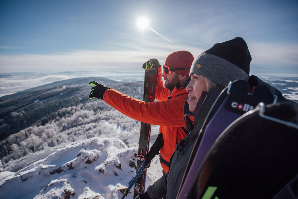
Trasa začíná v Horním Hanychově po vystoupení z tramvaje nebo na blízkém parkovišti. Od spodní stanice lanovky Skalka se stoupá lesem na oblíbenou chatu KČT Pláně pod Ještědem. Po hřebínku vzhůru k Ještědu, trasa protne linii 15. poledníku. Po sjezdovkách zpět do Liberce.
Peak
- Country
- Czech
- Montains
- Jizera Mountains
- Tags
- Czech Republic české hory Ještěd Jizerské hory Liberec skialpujdoma ski touring with children
- Hut
- Ještěd - Jizerské hory
- UTM / CH1903 x ("longitude" E/W)
- 33U 498937
- UTM / CH1903 y ("latitude" N/S)
- 5620090
Start point
- Start Point
- Horní Hanychov - tram
- Altitude
- 525 m
- UTM / CH1903 x ("longitude" E/W)
- 33U 500843
- UTM / CH1903 y ("latitude" N/S)
- 5620715
- village, valley
- Liberec
- cableway / lift
- tram to Horní Hanychov
- Photo by
- naskialpechpreshory.cz, naskialpechpreshory.cz
- Participed on tour mapping
- naskialpechpreshory.cz, naskialpechpreshory.cz
Conditions
- Weather
- Smrk 1124 m, mountain-forecast.com Świeradów Zdrój, snow-forecast.com Smrk 1124 m meteoblue.com Ještěd 1012m, ventusky.com Ještěd 1012m, meteoblue.com Ještěd 1012m, in-počasí.cz ČR - kompletní informační servis ČR - předpovědní model Aladin
- Snow report
- Ještěd, snow-forecast.com Ještěd, snow.cz Ještěd, bergfex.com Swieradów Zdrój, snow-forecast.com Swieradów Zdrój, snow.cz Swieradów Zdrój, bergfex.com
- Webcams
- Jizerky.eu - all webcams Ještěd skiareál Ještěd, bergfex Swieradów Zdrój Nové Město pod Smrkem
Ski tour map on Ještěd přes Pláně pod Ještědem
 bivakovací nouzová chata
  cepín a mačky potřeba
 exponovaný, obtížný terén
 horská chata
 hôtel, penzion
 lanovka, vlek
 lavinové nebezpečí, svah > 30°
 ledovcové trhliny
 lehká túra
 mimořádně obtížná túra
 mírně obtížná túra
 obtížná túra
 parkoviště
 přístup k chatě
 restaurace
 sedlo
sedlo sjezd
sjezd skidepo
 vrchol
 výstup
 začátek ledovce
 bivouac, winter room
 crampons & ice axe necessary
 exposed, difficulty terrain
 mountain hut, refuge
 hotel, pension
 cableway, skilift
 avalanche danger, slope > 30°
 glacier cracks
 little difficult tour
 extremely difficult tour
 rather difficult tour
 difficult tour
 parking
 hut acces
 restaurant
 col, pass, saddle
 descent
 skidepot
 peak, summit
 ascent
 glacier beginning
 biwak, winterraum
 steigeisen & pickel erforderlich
 ausgesetzt, schwierige gelände
 berghütte
 hotel, pension
 seilbahn, skilift
 lawinengefahr, hangneigung > 30°
 gletscherspalten
 wenig schwierige tour
 äusserst schwierige tour
 ziemlich schwierige tour
 schwierige tour
 parkplatz
 zugang zur hütte
 restaurant
 sattel, joch, pass
 abfahrt
 skidepot
 gipfel
 aufsieg
 gletscher anfang
 bivacco, locale invernale
 ramponi & piccozza necessari
 esposto, terreno difficolt?
 rifugio, capanna
 alberghi, pensione
 funivia, seggiovia
 pericolo di valanghe, pendenza > 30°
 crepe glacier
 tour piccolo difficile
 tour estremamente difficile
 tour piuttosto difficile
 escursioni difficili
 parcheggio
 accesso capanna
 ristorante
 col, sella, passo, forcella
 discesa
 sci deposito
 picco, vertice, piz
 salita
 inizio ghiacciaio
 bivouac, local d'hiver
 crampons & piolet nécessaire
 exposée, difficulté du terrain
 cabane de montagne, refuge
 hôtel, pension
 téléphérique, téléski
 danger d'avalanche, pente > 30°
 crevasse du glacier
 peu difficile tour
 extr?mement difficile tournée
 assez difficile tour
 difficile tournée
 parking
 acces cabane
 restaurant
 col, selle
 descente
 skis dépôt
 pic, sommet
 ascension
 début glacier
- < 20°
- 20° - 25°
- 25° - 30°
- 30° - 35°
- 35° - 40°
- > 40°
Planning of ski tour
- Fitness difficulty
-
- ♦◊◊◊
- Technical difficulty
-
- ♦◊◊◊
- best time for this tour
- all winter
- Glacier
- No
- Map
- Jizerské hory, Geodézie OnLine, 1:25000 Jizerské hory, KČT, 1:50000 Jizerské hory - zimní mapa, Shocart, 1:50000
- Guides
- Skitour.Guru
About Ski tour
- Time difficulty
- Ascent (height difference)
- 500 m
- Lenght of ascent
- 5,5 km
- Descent (height difference)
- 500 m
- Total Lenght of tour
- 7 km
- Total time of the tour
- h
- Elevation Range
- 525 - 1012 m
- Principal Aspect
- not important S-south, N-north, W-west, E-east
Download
- GPX (track only)
- JIZ_Jested_Liberec_TRACK.gpx best for display on a detailed topographical map (mapy.cz) or in apps for smartphones (Locus, Garmin Connect, etc.)
- GPX (waipoints, track)
- JIZ Jested_Liberec_SKITOUR.gpx great for uploading in GPS device
- KML (with POI)
- Jested_Liberec_SKITOUR.kml for viewing in the Google Earth 3D map application, which you can install on your PC
Video of tour on Ještěd přes Pláně pod Ještědem
tour Ještěd přes Pláně pod Ještědem - Reviews
There are no reviews in this section yet. Click the Add Review button to add first review.
Ski tours around Hut Ještěd - Jizerské hory, in mountains Jizera Mountains, Czech
-
Ještěd - trasa Bike 887 m
Ještěd - Jizerské hory Jizera Mountains Czech
- Length of ascent3 km
- ascent365 m
- duration h
- Fitness difficulty ♦◊◊◊
- Technical difficulty ♦◊◊◊
Trasa Bike v areálu Ještěd vede od spodní stanice lanovky Skalka lesem k chatě KČT Pláně pod Ještědem k horní stanici lanovky Černý kopec. Dolů po sjezdovce.

-
Ještěd - trasa Frantina 925 m
Ještěd - Jizerské hory Jizera Mountains Czech
- Length of ascent4 km
- ascent565 m
- duration h
- Fitness difficulty ♦◊◊◊
- Technical difficulty ♦◊◊◊
Delší trasa po svazích Ještědu z Horního Hanychova přes chatu KČT Pláně pod Ještědem (výstavka z historie Horské služby Jizerky) pod Černý vrch a odtud sjezd na Skalku.

-

Ještěd - trasa Úvozem 1012 m
Ještěd - Jizerské hory Jizera Mountains Czech
- Length of ascent3 km
- ascent425 m
- duration h
- Fitness difficulty ♦◊◊◊
- Technical difficulty ♦◊◊◊
Trasa zvaná Úvozem začíná u spodní stanice lanovky na Ještěd a klikatí se po východních svazích Jestědu na vrchol. Návrat do Liberce po sjezdovkách. Značení tras pro fitness skitouring na Ještědu zajišťují chlapi z Horské služby a finační podpory značení se ujala firma Nalehko.com.

-
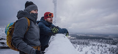
Smrk - Jizerské hory 1124 m
Ještěd - Jizerské hory Jizera Mountains Czech
- Length of ascent8 km
- ascent760 m
- duration3,5-5 h
- Fitness difficulty ♦◊◊◊
- Technical difficulty ♦◊◊◊
Snadná túra na nejvyšší horu Jizerek, na jejímž vrcholu se můžete pokochat z rozhledny. Stačí se kousek posunout za hranice a užít si i oblouky na sjezdovce střediska Swieradów Zdrój.


 Česky
Česky Deutsch


