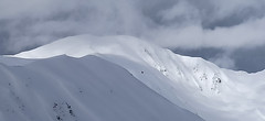
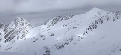
Túra na Kreuzspitze patří k nejoblíbenějším v oblasti Kalksteinu. Široký svah nabízí variabilitu sjezdové trasy. Od mohtného kříže na vrcholu je parádní výhled.
Peak
- Country
- Austria
- Montains
- Villgratner Berge - Deferegger Alpen
- Tags
- Alps2000 Austria Defereggen Alpen Innervillgraten Österreich Osttirol Austria ski touring Villgratener Berge Villgratental
- Hut
- Kalkstein - Villgratental
- UTM / CH1903 x ("longitude" E/W)
- 33T 295068
- UTM / CH1903 y ("latitude" N/S)
- 5189688
Start point
- Start Point
- Kalkstein - Villgratental
- Altitude
- 1640 m
- UTM / CH1903 x ("longitude" E/W)
- 33T 295382
- UTM / CH1903 y ("latitude" N/S)
- 5186922
Conditions
- Avalanche danger
- Lawine Tirol
- Weather
- Innervillgraten 1530 m / meteoblue.com Thurntaler 2408 m / meteoblue.com Helm / Monte Helmo / mountain-forecast.com Bergwetter Tirol 2 days Tirol / ORF.at Tirol - Austria ZAMG
- Snow report
- Sillian / snow-forecast.com St. Jakob Defereggental / snow-forecast.com Sillian / onthesnow.com St. Jakob Defereggental / onthesnow.com Sillian / bergfex.at St. Jakob Defereggental / bergfex.at
- Webcams
- Innervillgraten - Ort 1402 m Kalkstein parkplatz 1640 m Kreuzspitze 2614 m Sillian - Bergstation 6-Bahn 2408 m Bergstation Ausservillgraten 2200 m St. Jakob Defereggental / bergfex.at
Ski tour map on Kreuzspitze
 bivakovací nouzová chata
  cepín a mačky potřeba
 exponovaný, obtížný terén
 horská chata
 hôtel, penzion
 lanovka, vlek
 lavinové nebezpečí, svah > 30°
 ledovcové trhliny
 lehká túra
 mimořádně obtížná túra
 mírně obtížná túra
 obtížná túra
 parkoviště
 přístup k chatě
 restaurace
 sedlo
sedlo sjezd
sjezd skidepo
 vrchol
 výstup
 začátek ledovce
 bivouac, winter room
 crampons & ice axe necessary
 exposed, difficulty terrain
 mountain hut, refuge
 hotel, pension
 cableway, skilift
 avalanche danger, slope > 30°
 glacier cracks
 little difficult tour
 extremely difficult tour
 rather difficult tour
 difficult tour
 parking
 hut acces
 restaurant
 col, pass, saddle
 descent
 skidepot
 peak, summit
 ascent
 glacier beginning
 biwak, winterraum
 steigeisen & pickel erforderlich
 ausgesetzt, schwierige gelände
 berghütte
 hotel, pension
 seilbahn, skilift
 lawinengefahr, hangneigung > 30°
 gletscherspalten
 wenig schwierige tour
 äusserst schwierige tour
 ziemlich schwierige tour
 schwierige tour
 parkplatz
 zugang zur hütte
 restaurant
 sattel, joch, pass
 abfahrt
 skidepot
 gipfel
 aufsieg
 gletscher anfang
 bivacco, locale invernale
 ramponi & piccozza necessari
 esposto, terreno difficolt?
 rifugio, capanna
 alberghi, pensione
 funivia, seggiovia
 pericolo di valanghe, pendenza > 30°
 crepe glacier
 tour piccolo difficile
 tour estremamente difficile
 tour piuttosto difficile
 escursioni difficili
 parcheggio
 accesso capanna
 ristorante
 col, sella, passo, forcella
 discesa
 sci deposito
 picco, vertice, piz
 salita
 inizio ghiacciaio
 bivouac, local d'hiver
 crampons & piolet nécessaire
 exposée, difficulté du terrain
 cabane de montagne, refuge
 hôtel, pension
 téléphérique, téléski
 danger d'avalanche, pente > 30°
 crevasse du glacier
 peu difficile tour
 extr?mement difficile tournée
 assez difficile tour
 difficile tournée
 parking
 acces cabane
 restaurant
 col, selle
 descente
 skis dépôt
 pic, sommet
 ascension
 début glacier
- < 20°
- 20° - 25°
- 25° - 30°
- 30° - 35°
- 35° - 40°
- > 40°
Planning of ski tour
- Fitness difficulty
-
- ♦♦◊◊
- Technical difficulty
-
- ♦♦◊◊
- best time for this tour
- Dezember-April
- Glacier
- No
- Map
- Villgratental- Sillian, 1:25.000, Tabacco 073 Innervillgraten, 1:25.000 BEV-Karte 3102-West
- Guides
- Skitourenführer Tirol / Alpinverlag, deutsch Skitouren in Osttirol und Oberkärnten: Hohe Tauern / Tyrolia / deutsch Tiroler Skitouren Handbuch / Michael Wagner Verlag / deutsch Pustertal / Bergverlag Rother / deutsch SCHITOUREN-ATLAS ÖSTERREICH WEST / Schall Verlag / deutsch
About Ski tour
- Time difficulty
- Ascent (height difference)
- 955 m
- Lenght of ascent
- 5,5 km
- Descent (height difference)
- 955 m
- Total Lenght of tour
- 11 km
- Total time of the tour
- 3,5-5 h
- Elevation Range
- 1640 - 2624 m
- Principal Aspect
- S, SE S-south, N-north, W-west, E-east
Download
- GPX (track only)
- Kreuzspitze_Kalkstein_TRK.gpx best for display on a detailed topographical map (mapy.cz) or in apps for smartphones (Locus, Garmin Connect, etc.)
- GPX (waipoints, track)
- Kreuzspitze_Kalkstein_skitour.gpx great for uploading in GPS device
- KML (with POI)
- Kreuzspitze_Kalkstein_skitour.kml for viewing in the Google Earth 3D map application, which you can install on your PC
tour Kreuzspitze - Reviews
There are no reviews in this section yet. Click the Add Review button to add first review.
Ski tours around Hut Kalkstein - Villgratental, in mountains Villgratner Berge - Deferegger Alpen, Austria
-

Marchkinkele from Kalkstein 2545 m
Kalkstein - Villgratental Villgratner Berge - Deferegger Alpen Austria
- Length of ascent4 km
- ascent875 m
- duration3,5-5 h
- Fitness difficulty ♦♦◊◊
- Technical difficulty ♦♦◊◊
Skialpová túra Marchkinkele je jednou z tras ve Villgratentalu, která je poměrně často ohrožena lavinami. Díky své severní poloze však prachový sníh vydrží dlouho do jara a podmínky jsou obvykle ideální. Od sedla Gisser Törl nahoru je sníh často ovlivňován větrem.

-

Gaishörndl 2604 m
Kalkstein - Villgratental Villgratner Berge - Deferegger Alpen Austria
- Length of ascent4,5 km
- ascent980 m
- duration4-5,5 h
- Fitness difficulty ♦♦◊◊
- Technical difficulty ♦♦◊◊
Gaishörndl je často navštěvovaná hraniční hora v oblasti Kalkstein. Túru lze absolvovat téměř každý den po celou zimu. Optimální sklon sjezdu a díky své jihovýchodní poloze také krásná firnová túra. Výhledy na Dolomity a údolí Pustertal až k Toblachu.

-

Toblacher Pfannhorn 2663 m
Kalkstein - Villgratental Villgratner Berge - Deferegger Alpen Austria
- Length of ascent5,5 km
- ascent1040 m
- duration4-5,5 h
- Fitness difficulty ♦♦◊◊
- Technical difficulty ♦♦◊◊
Vrchol Toblacher Pfannhorn stojí za to nejen kvůli fantastickému výhledu na Dolomity s Tre Cime, ale také kvůli výhledům na Lienzské Dolomity nebo hlavní alpský hřeben. Poněkud strmější sjezd po vrcholovém hřebenu je při dostatku sněhu velmi atraktivní.

-

Pürglesgungge 2500 m
Kalkstein - Villgratental Villgratner Berge - Deferegger Alpen Austria
- Length of ascent4 km
- ascent890 m
- duration4-5,5 h
- Fitness difficulty ♦♦◊◊
- Technical difficulty ♦◊◊◊
Skialpová túra na Pürglesgungge je nádherná nad hranicí lesa. Krásné výhledy dolů do údolí Villgratental a do protějšího údolí Marchental s výstupem na Marchkinkele. Rozsáhlý terén nabízí za bezpečných podmínek skvělý sjezd do údolí Alfental.

Best ski tours in Villgratner Berge - Deferegger Alpen by skitour.guru
-

Grosses Degenhorn 2937 m
Innervillgraten Villgratner Berge - Deferegger Alpen Austria
- Length of ascent11 km
- ascent1470 m
- duration7,5-9,5 h
- Fitness difficulty ♦♦♦◊
- Technical difficulty ♦♦◊◊
Skialpová túra na Grosses Degenhorn míří na jeden z nejvyšších vrcholů pohoří Villgraten, a proto je z něj skvělý výhled. Nádherný firnový sjezd si musíte zasloužit dlouhým výstupem přes údolí Arntal. Díky své výšší poloze je možné túru podniknout i v květnu. V jarních podmínkách je nutné počítat s dlouhou chůzí bez lyží údolím Arntal.

-

Hochstein 2827 m
Innervillgraten Villgratner Berge - Deferegger Alpen Austria
- Length of ascent6,5 km
- ascent1150 m
- duration4-6 h
- Fitness difficulty ♦♦♦◊
- Technical difficulty ♦♦◊◊
Skialpová túra na Hochstein je členitá a zajímavá. Za almem Kamelisenalm se stoupá mírným táhlým západním svahem do sedla Öwelenke. Krátký sjezd na pásech a hned doleva traverzem směrem k jezeru (nesjíždět až dolů k potoku). Nejprudší výstup túry je z kotliny nad jezerem. Závěr výstupu na vrchol vede táhlým mírným svahem. Sjezd po trse výstupu. Alternativou je za dobrých podmínek přelezení hřebínku z posledního sedla do sektoru trasy na Rotes Kinkele a po dosažení vrcholu sjíždet trasou z Rotes Kinkele, která je sjezdařsky zajímavější.

-

Rotes Kinkele 2754 m
Innervillgraten Villgratner Berge - Deferegger Alpen Austria
- Length of ascent5,5 km
- ascent1065 m
- duration4-6 h
- Fitness difficulty ♦♦◊◊
- Technical difficulty ♦♦♦◊
Rotes Kinkele je výborná túra uprostřed oblasti a tak poskytuje z vrcholu výhled na všechny zásadní kopce oblasti. Po lesních cestách na malebný Kamelisenalm a pak vlevo od potoka stále nahoru. Na počátku dlouhého hřebenu na vrchol je potřeba vyhodnotit, zda bude schůdný na pásech nebo v mačkách. Výšlap na pyramidu k vrcholovému kříži je snadný. Sjezd kopíruje trasu výstupu


 Česky
Česky Deutsch


