Česky
Česky Deutsch
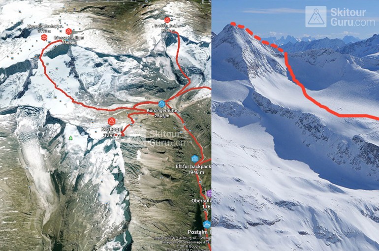
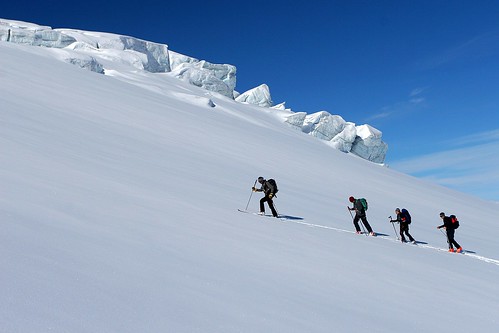
Grossvenediger is a distinctive pyramid peak, Austria's 4th highest mountain, in the middle of the glacial mountains in the mountain group Venedigergruppe in the Hohe Tauern. The ski tour of the Kürsinger Hütte runs almost all along the glaciers, over the Venedigerscharte saddle. In the end, skis are removed from the top, and in the cats with an aspen can be reached after a simple ridge to the top.
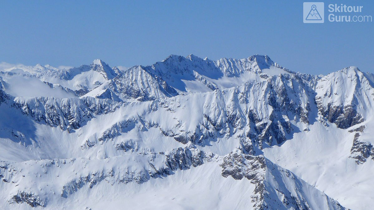
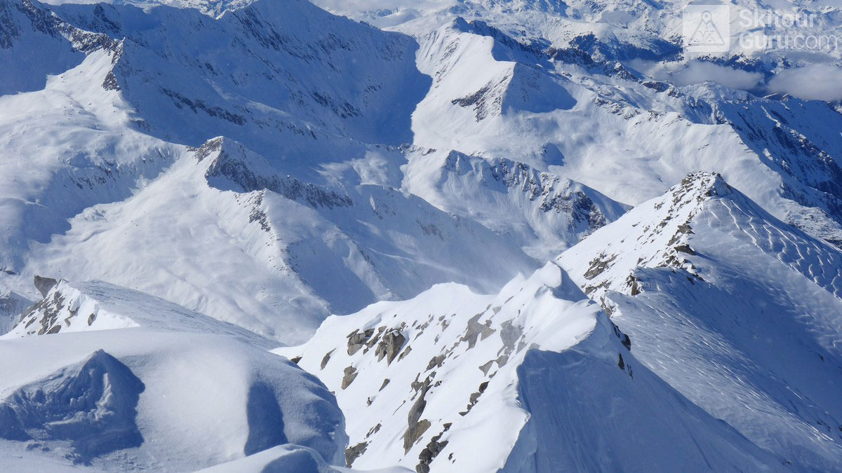
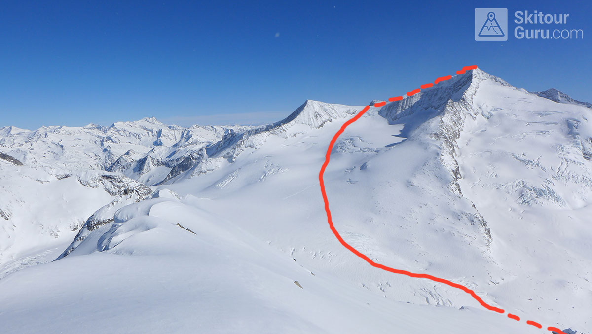
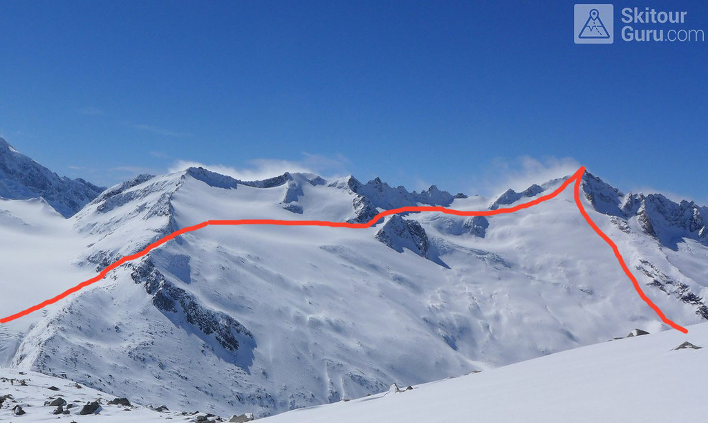
A shorter sightseeing tour of Keeskogel provides a fantastic panorama to the entire area of the main Alpine ridge. Hohe Tauern marvelous view point - Grossvenediger, Grosser Geiger and Schlieferspitze. The final exposed ridge requires a little climbing skill, grade I to II. UIAA. Depends on the snow conditions.
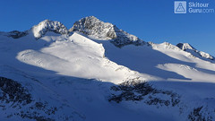
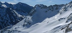
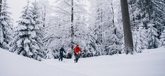
 Vyhlídka cestou na Keeskogel. Grosser Geiger se klube z mraků..
Hide notes
Vyhlídka cestou na Keeskogel. Grosser Geiger se klube z mraků..
Hide notes
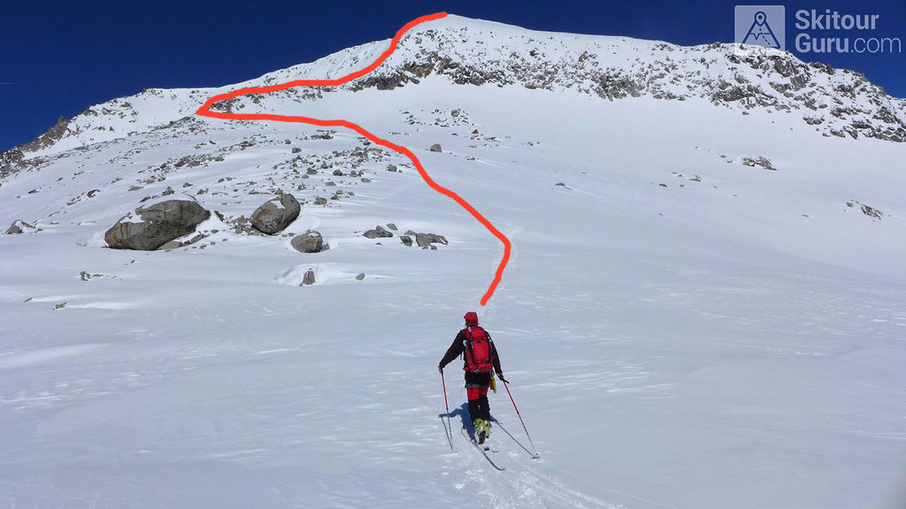
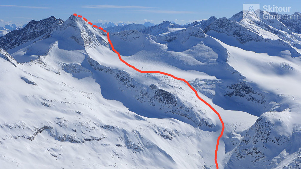
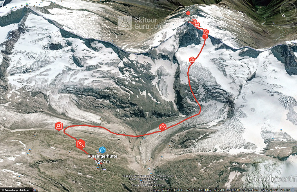
Grosser Geiger is a challenging skiing on the glacier terrain of the Alpine Mountains of Venedigergruppe. It is available from Kürsinger Hütte on the north-facing slopes and from the Essener-Rostocker Hütte on the southern slopes. The most difficult part of the exit is to overcome the steep height on the main ridge.
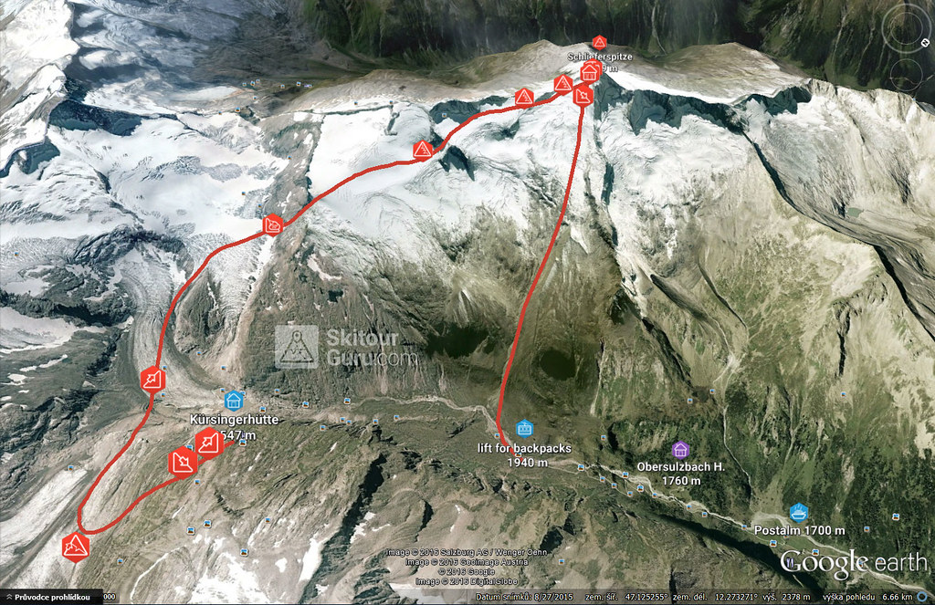
The relatively demanding glacier tour of the Schlieferspitze. For a stay at the Kürsinger Hütte, it is perfect for the last day. After leaving, take the eastern slope down the Sulzbachtal valley to the parking lot. It's actually the only way to get out of bed at Postalm.
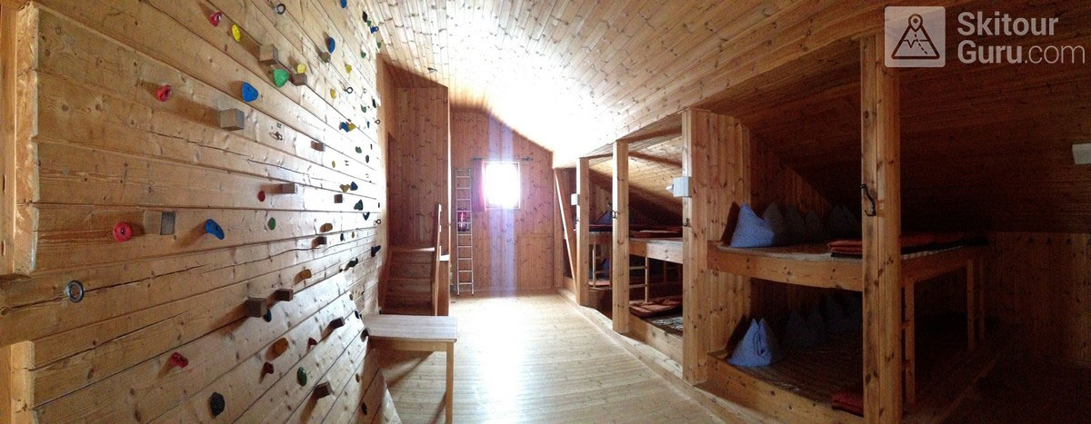
If you do not have a day of nice weather, the Kürsinger Hütte offers a climbing wall, where you can rehearse the body, as well as rescue from the ice crack...
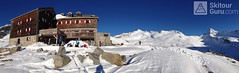
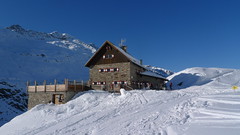
KÜRSINGER HÜTTE 2457m - infoservice, gpx of access and skitour links
GROSSVENEDIGER 3666m - infoservice, gpx download for your navigation and skitour photoguide.
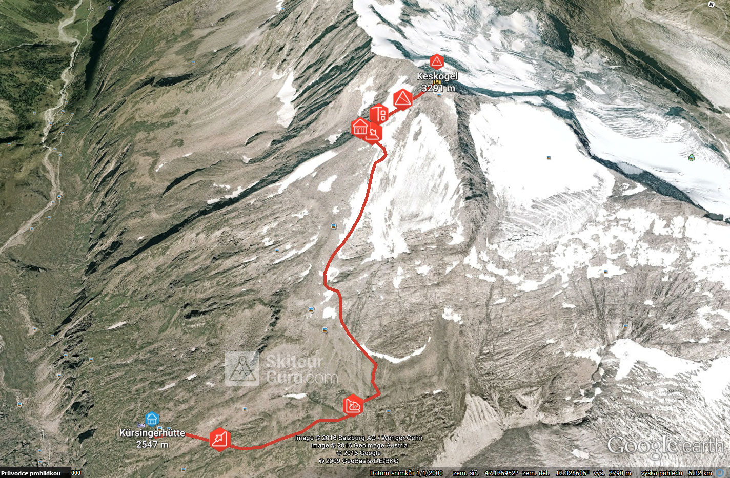
KEESKOGEL 3291m - infoservice, gpx download for your navigation and skitour photoguide.
GROSSER GEIGER 3360m - infoservice, gpx download for your navigation
SCHLIEFERSPITZE 3289m - infoservice, gpx download for your navigation
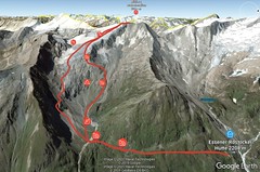
For a careful planning of the tour, download the *.kml or *.gpx file and open it in Google Earth. In this 3D map, you can easily navigate through virtual tours, zoom in and zoom out for true terrain imagery, and also check the status of glaciers.