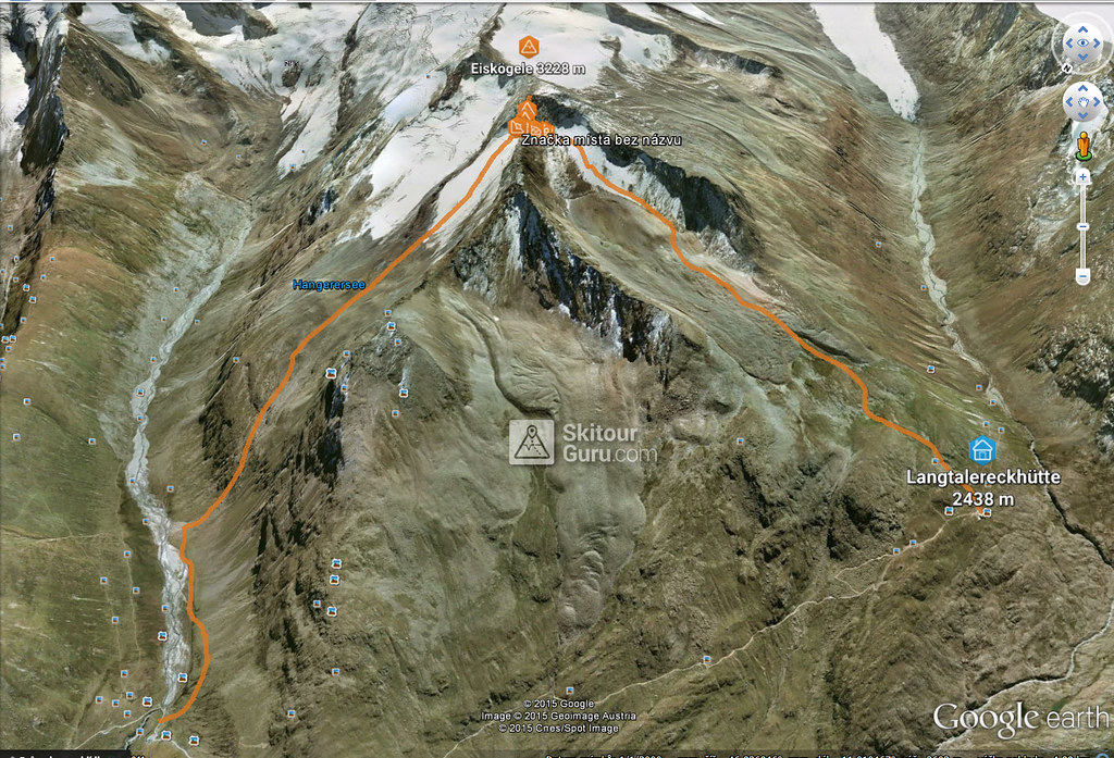
Eiskögele is a good moderate tour for the last day on the Langtalereckhütte (Ötztaler Alpen). After climbing to the top, you can get off the saddle on the edge of the Obergurgl ski resort and down the slopes to the village.
Peak
- Country
- Austria
- Montains
- Ötztal Alps / Alpi Venoste
- Tags
- Langtalereck Hütte Obergurgl Ötztal Tirol
- Hut
- Langtalereckhütte
- UTM / CH1903 x ("longitude" E/W)
- 32 T 651918
- UTM / CH1903 y ("latitude" N/S)
- 5182033
Start point
- Start Point
- Langtalereckhütte
- Altitude
- 2426 m
- UTM / CH1903 x ("longitude" E/W)
- 32 T 651918
- UTM / CH1903 y ("latitude" N/S)
- 5188046
- village, valley
- Obergurgl
- cableway / lift
- yes, by Steinmannbahn
Conditions
- Avalanche danger
- LWD Tirol
- Weather
- ZAMG ORF wetter.at bergfex.at yr.no - Langtalereckhütte yr.no - Mittl. Seelenkogel yr.no - Schalfkogel
- Snow report
- snow-forecast.com schneeradar.de
- Webcams
- Webcams Travel schneeradar.de
Ski tour map on Eiskögele
 bivakovací nouzová chata
  cepín a mačky potřeba
 exponovaný, obtížný terén
 horská chata
 hôtel, penzion
 lanovka, vlek
 lavinové nebezpečí, svah > 30°
 ledovcové trhliny
 lehká túra
 mimořádně obtížná túra
 mírně obtížná túra
 obtížná túra
 parkoviště
 přístup k chatě
 restaurace
 sedlo
sedlo sjezd
sjezd skidepo
 vrchol
 výstup
 začátek ledovce
 bivouac, winter room
 crampons & ice axe necessary
 exposed, difficulty terrain
 mountain hut, refuge
 hotel, pension
 cableway, skilift
 avalanche danger, slope > 30°
 glacier cracks
 little difficult tour
 extremely difficult tour
 rather difficult tour
 difficult tour
 parking
 hut acces
 restaurant
 col, pass, saddle
 descent
 skidepot
 peak, summit
 ascent
 glacier beginning
 biwak, winterraum
 steigeisen & pickel erforderlich
 ausgesetzt, schwierige gelände
 berghütte
 hotel, pension
 seilbahn, skilift
 lawinengefahr, hangneigung > 30°
 gletscherspalten
 wenig schwierige tour
 äusserst schwierige tour
 ziemlich schwierige tour
 schwierige tour
 parkplatz
 zugang zur hütte
 restaurant
 sattel, joch, pass
 abfahrt
 skidepot
 gipfel
 aufsieg
 gletscher anfang
 bivacco, locale invernale
 ramponi & piccozza necessari
 esposto, terreno difficolt?
 rifugio, capanna
 alberghi, pensione
 funivia, seggiovia
 pericolo di valanghe, pendenza > 30°
 crepe glacier
 tour piccolo difficile
 tour estremamente difficile
 tour piuttosto difficile
 escursioni difficili
 parcheggio
 accesso capanna
 ristorante
 col, sella, passo, forcella
 discesa
 sci deposito
 picco, vertice, piz
 salita
 inizio ghiacciaio
 bivouac, local d'hiver
 crampons & piolet nécessaire
 exposée, difficulté du terrain
 cabane de montagne, refuge
 hôtel, pension
 téléphérique, téléski
 danger d'avalanche, pente > 30°
 crevasse du glacier
 peu difficile tour
 extr?mement difficile tournée
 assez difficile tour
 difficile tournée
 parking
 acces cabane
 restaurant
 col, selle
 descente
 skis dépôt
 pic, sommet
 ascension
 début glacier
- < 20°
- 20° - 25°
- 25° - 30°
- 30° - 35°
- 35° - 40°
- > 40°
Planning of ski tour
- Fitness difficulty
-
- ♦♦◊◊
- Technical difficulty
-
- ♦♦♦◊
- best time for this tour
- since march
- Glacier
- Yes
- Map
- Gurgl, OEAV 1:25000, Nr. 30/1
- Guides
- Skitourenführer Tirol Ötztal – Silvretta SCHITOUREN-ATLAS ÖSTERREICH WEST
About Ski tour
- Time difficulty
- Ascent (height difference)
- 800 m
- Lenght of ascent
- 3 km
- Descent (height difference)
- 748 m
- Total Lenght of tour
- 6 km
- Total time of the tour
- 1,5-2 h
- Elevation Range
- 2426 - 3228 m
- Principal Aspect
- N, NW S-south, N-north, W-west, E-east
Download
- GPX (track only)
- Eiskoegele_LangtalereckHte_TRACK.gpx best for display on a detailed topographical map (mapy.cz) or in apps for smartphones (Locus, Garmin Connect, etc.)
- GPX (waipoints, track)
- Eiskoegele_TOUR.gpx great for uploading in GPS device
- KML (with POI)
- Eiskögele_3228m_TOURmap.kml for viewing in the Google Earth 3D map application, which you can install on your PC
tour Eiskögele - Reviews
There are no reviews in this section yet. Click the Add Review button to add first review.
Ski tours around Hut Langtalereckhütte, in mountains Ötztal Alps / Alpi Venoste, Austria
-

Mittlerer Seelenkogel 3426 m
Langtalereckhütte Ötztal Alps / Alpi Venoste Austria
- Length of ascent5 km
- ascent1000 m
- duration4-5,5 h
- Fitness difficulty ♦♦◊◊
- Technical difficulty ♦♦♦◊
Mittlerer Seelenkogel (Langtalereck Hütte, Ötztaler Alpen) is a rather difficult skitour for his second half. Traverse in steep terrain and the finish can be done under good conditions only.

-

Hohe Wilde / Hochwilde 3461 m
Langtalereckhütte Ötztal Alps / Alpi Venoste Austria
- Length of ascent8 km
- ascent1040 m
- duration6-8 h
- Fitness difficulty ♦♦♦◊
- Technical difficulty ♦♦♦♦
Hohe Wilde (Langtalereck Hütte, Ötztaler Alpen) is a distinctive mountain at the end of the Langtaler Ferner glacier with a challenging finisch to the summit.

-
Annakogel 3336 m
Langtalereckhütte Ötztal Alps / Alpi Venoste Austria
- Length of ascent8 km
- ascent1300 m
- duration5-7 h
- Fitness difficulty ♦♦♦◊
- Technical difficulty ♦♦◊◊
ANNAKOGEL is the lightest tour of the Langtalereck Hütte on the glacier Gurgler Ferner in the Tyrol Ötztaler Alpen. Beautiful view of Schalfkogel and Hohe Wilde.

-
Schalfkogel E (Langtalereck H.) 3537 m
Langtalereckhütte Ötztal Alps / Alpi Venoste Austria
- Length of ascent7 km
- ascent1500 m
- duration5,5-7 h
- Fitness difficulty ♦♦♦◊
- Technical difficulty ♦♦♦◊
Schalfkogel (Langtalereck Hütte, Ötztaler Alpen) is a relatively demanding tour. After climbing the glacier Gurgler Ferner is a challenging steep steep part of the glacier Kleinleiten Ferner. From the saddle Schalfkogeljoch longer and harder ascent without skis. The mountain is also accessible from Martin Busch Hütte.

-
Hinterer Seelenkogel 3475 m
Langtalereckhütte Ötztal Alps / Alpi Venoste Austria
- Length of ascent9 km
- ascent1140 m
- duration5-7 h
- Fitness difficulty ♦♦♦◊
- Technical difficulty ♦♦◊◊
Hinterer Seelenkogel (Langtalereck Hütte, Ötztaler Alpen) is a ski tour between North and South Tyrol. Avalanche danger wait at the beginning of the exit from the Langtal valley.

Best ski tours in Ötztal Alps / Alpi Venoste by skitour.guru
-
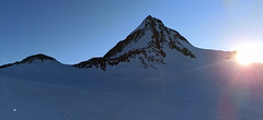
Finailspitze North (from Hochjoch Hospiz) 3514 m
Hochjoch Hospiz Ötztal Alps / Alpi Venoste Austria
- Length of ascent7 km
- ascent1390 m
- duration5,5-7 h
- Fitness difficulty ♦♦♦◊
- Technical difficulty ♦♦♦◊
The tour to Fineilspitze begins with a short descent from the Hochjoch Hospiz hut into the valley of the Rofenache stream. Cross the stream and ascend on the right-hand side above the gorge. After the valley widens, continue left up over a moraine onto the glacier. On the glacier, head right of the ridge to a point at 3447 m. Leave the skis there and continue without them, using crampons, over exposed terrain along the ridge to the summit. Descent follows the ascent route.

-
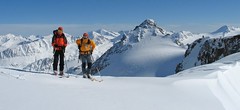
Fluchtkogel SE, from Vernagthütte 3500 m
Vernagthütte Ötztal Alps / Alpi Venoste Austria
- Length of ascent4 km
- ascent740 m
- duration3-4,5 h
- Fitness difficulty ♦♦♦◊
- Technical difficulty ♦♦◊◊
Túra na Fluchtkogel z Vernagthütte je výletem za krásnými výhledy přes celé Ötztálské Alpy. Jediný prudší úsek je pod sedle Oberes Guslarjoch a ještě v závěrečném svahu na plochý vrchol. Dolů kolem výstupových stop.

-
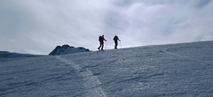
Hintere Schwärze 3624 m
Martin-Busch-Hütte Ötztal Alps / Alpi Venoste Austria
- Length of ascent6,5 km
- ascent1300 m
- duration5,5-7 h
- Fitness difficulty ♦♦◊◊
- Technical difficulty ♦♦♦◊
Hintere Schwärze je vrchol, schovaný trošku stranou. Patří mezi top10 nejvyšších hor Rakouska. Po sjezdu od chaty se trasa stáčí doprava na ledovec Marzellferner. Po ledovci mírně nahoru. Následuje prudší svah k závěrečnému výšvihu. Od skidepa v mačkách a s cepínem na vrchol, jednoduchým terénem.


 Česky
Česky Deutsch


