
 Česky
Česky Deutsch


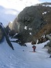


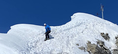
Cabane Valsorey is a traditional mountain hut on the classic haute route Chamonix - Zermatt. The hut can be reached from Bourg St-Pierre or Cabane Vélan via a ski tour over Mont Vélan. The climb to the Grand Combin is very challenging. The famous ski tour is the haute route over the Plateau Couloir to the hut Cabane Chanrion.
Tours starting from hut
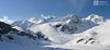
Ski tours around Hut Cabane Valsorey

- Country
- Switzerland
- Montains
- Walliser Alpen / Alpes valaisannes
- Open (winter)
- mid March - mid May
- Beds
- 60
- Winterraum
- yes, 30 beds
- Shortening of access (cableway, lift, taxi, snowcat...)
- no
- Luggage transport
- no
- Shower
- no
- Wifi
- no
- UTM / CH1903 x ("longitude" E/W)
- 587060
- UTM / CH1903 y ("latitude" N/S)
- 86544
- GPX access to hut (waipoints, track)
- Valsorey-Hut_access_BourgStPierre_skitour.gpx
- GPX access to hut (track only)
- Valsorey-Hut_access_Bourg-St-Pierre_TRK.gpx
- Map
- Arolla 283 S, Swisstopo 1:50000 Chanrion 1346, Swisstopo 1:25000 Mont Vélan 1366, Swisstopo 1:25000 Orsiéres 1345, Swisstopo 1:25000
- Guides
- Ski de randonnée Bas-Valais Die klassischen Skitouren (SAC, deutsch) Les classiques de randonnée à ski (SAC, francais) Walliser Alpen (Rother, deutsch)
- Phone (hut)
- 0041(0)27 7871122
- Phone (valley)
- 0041(0) 78 625 52 42
- Cell phone
- -
- Web
- valsorey.ch
- info@valsorey.ch
- Owner of hut
- SAC Sektion La Chaux-de-Fonds
- Cabane Valsorey
- Reservation
- phone, e-mail
- Start Point
- Bourg St. Pierre
- UTM / CH1903 x ("longitude" E/W)
- 582257
- UTM / CH1903 y ("latitude" N/S)
- 88683
- Altitude
- 1655 m
- Ascent (height difference)
- 1400 m
- Time of Access
- 5-6,5 h
- Shortening lift
- no
- Avalanche danger
- www.slf.ch
- Weather
- SRF Meteo Meteoschweiz Combin Meitin, mountain-forecast.com Cab. Valsorey, Meteoblue.com Plateau Couloir, Meteoblue.com Gr. Combin Valsorey, mountain-forecast.com Gr. Tete de By, mountain-forecast.com Bourg St.-Pierre, yr.no Bourg St.-Pierre, meteoblue.com
- Snow report
- bergfex.ch, Liddes - Vichères
- Webcams
- Grand St. Bernard Tunnel
- Region
- Bourg-Saint-Pierre Wallis.ch Pays du Saint-Bernard
- Public traffic
- train SBB Bus - Postauto.ch
- Skiresort nearby
- Liddes - Vichères
- Other links
- Swiss Tourism
hut Cabane Valsorey - Reviews
There are no reviews in this section yet. Click the Add Review button to add first review.
Best ski tours in mountains Walliser Alpen / Alpes valaisannes, Switzerland
-

Fenetre Ferret - H.R. Grande Lui, Day 3 2698 m
La Fouly Walliser Alpen / Alpes valaisannes Switzerland
- Length of ascent11 km
- ascent1330 m
- duration5-7 h
- Fitness difficulty ♦♦♦◊
- Technical difficulty ♦♦◊◊
The Haute Route Grande Lui variant from Chamonix to Zermatt, also known as the "Haute Route Pure", leads from La Fouly to the Grand Saint Bernard Pass. Overnight accommodation is provided in the hospice of the same name, under conditions similar to those in a mountain hut. The traverse of the slope below the Ferret lakes is particularly prone to avalanches.

-

Pigne d´Arolla 3790 m
Cabane des Dix Walliser Alpen / Alpes valaisannes Switzerland
- Length of ascent6 km
- ascent1000 m
- duration5-7,5 h
- Fitness difficulty ♦♦◊◊
- Technical difficulty ♦♦♦◊
Pigne d´Arolla is a very popular and easily accessible viewpoint. The ski tour to the summit leads from the three mountain huts - Cabane Dix, Cabane Vignettes and Cabane Chanrion. The route from Dix goes around the glacial seracs to the saddle Col de la Serpentine and the summit can be reached on skis. A worthwhile summit on the Haute Routes to Zermatt.
-

Alphubel 4206 m
Britannia Hütte Walliser Alpen / Alpes valaisannes Switzerland
- Length of ascent10 km
- ascent1450 m
- duration7-10 h
- Fitness difficulty ♦♦♦◊
- Technical difficulty ♦♦♦◊
ALPHUBEL (Britannia Hütte, Walliser Alpen) is seemingly lighter 4000vka, but over are dangerous glacial cracks. Ski alpinists can also go from the Saas Fee ski area, most not far from the cable car station Langfluh .
Best ski tours in Switzerland by skitour.guru
-
Pizzo Lucendro 2963 m
Rotondohütte Urner Alps Switzerland
- Length of ascent5,5 km
- ascent1090 m
- duration4-6 h
- Fitness difficulty ♦♦◊◊
- Technical difficulty ♦♦♦◊
Pizzo Lucendro je výrazný vrchol nad Gotthardpassem a také prvotřídní rozhledna. Na túru lze vyrazit z údolního Realpu, snazší je start z chaty Rotondohütte. Po sjezdu nad úroveň salaší nastává dlouhý výstup členitým terénem, který nabírá na strmosti. Těsně pod skalním sedlem je v úzkém koridoru zvládání otočky nutností. Za sedlem následuje poměrně snadný výstup do sedla, k místu, kde bývá depo lyží. Při výstupu po hřebeni k vrcholovému kříži pozor na převěje a místy exponovaný terén. Při sjezdu za jarního firnu se vyplatí počkat v sedle, než slunce změkčí stinný svah pro velkolepý odpolední sjezd západním svahem. Z nejnižšího bodu návrat na chatu nebo sjezd až do Realpu.
-
Piz Palü 3882 m
Diavolezza Berghaus Bernina Alps Switzerland
- Length of ascent6,5 km
- ascent1180 m
- duration6,5-8,5 h
- Fitness difficulty ♦♦♦◊
- Technical difficulty ♦♦♦◊
The Piz Palü with its characteristic three pillars is probably the most popular "not 4000" in the Alps. The exit from the Berghaus Diavolezza is ideal, it is also possible from the Bovalhütte. The key point for the ascent and descent is the passage of the Labyrinth between the Seraks. Continue over a relatively steep glacier to the ski depot. Then ascent with ice axe and crampons along the exposed summit ridge. The usual goal of ski mountaineers is the eastern summit - 3882 m.
-

Vordere/ Hintere Jamspitze SW 3155 m
Tuoi Chamonna / Tuoihütte Silvretta Switzerland
- Length of ascent km
- ascent910 m
- duration3-4 h
- Fitness difficulty ♦♦◊◊
- Technical difficulty ♦♦◊◊